
Keyword
Earth Science | Biosphere | Aquatic Ecosystems | Plankton
7 record(s)
Type of resources
Topics
Keywords
Contact for the resource
Provided by
Formats
Representation types
Update frequencies
Status
draft
-
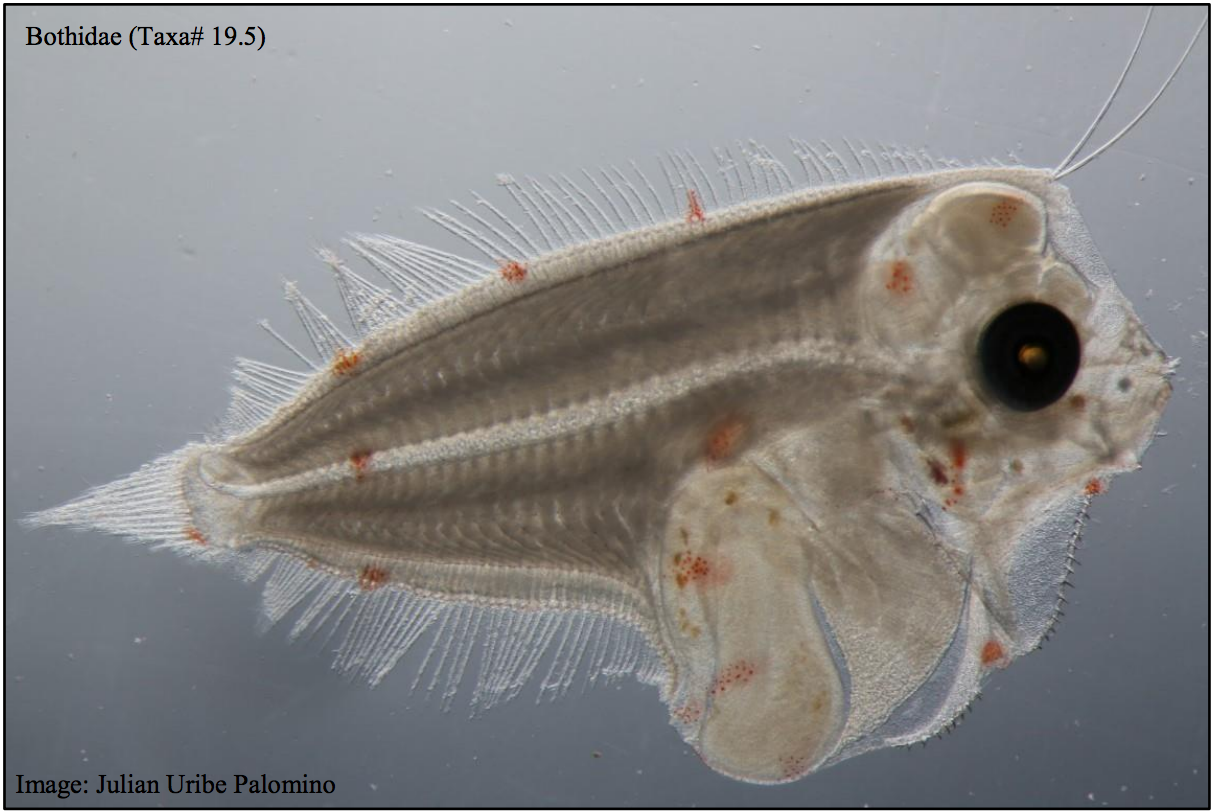
This dataset contains the ichthyoplankton data from three National Reference Stations on the east coast of Australia (North Stradbroke Island, Port Hacking, and Maria Island), and comparable historical data from eight ichthyoplankton surveys that were used to provide a longer term context: RV Sprightly (1983) RV Challenger (1989-1991) RV Franklin (1994) RV Franklin (1997-1998) RV Franklin (1998-1999) RV Southern Surveyor (2004) RV Investigator (2015) FRV Kapala (1989-1993) Refer to the published report which had the following goals: - To evaluate the value of long-term monitoring of ichthyoplankton at selected locations in the Integrated Marine Observing System (IMOS) National Reference Station (NRS) network, - To identify the potential of this monitoring for providing fishery-independent information relevant for marine fishes and their management. Note - Currently only the data from the IMOS NRS Stations have been made available.
-

Results from version 3.1 of the the 4km-resolution biogeochemistry and sediments model of the Great Barrier Reef (GBR4), forced by version2 of the Hydrodynamic model and by a reduced-loads catchment scenario which is derived from SOURCE Catchments with 2019 catchment condition (q3b) with anthropogenic loads (q3b – q3p) reduced according to the percentage reductions of DIN, PN, PP and TSS specified in the Reef 2050 Water Quality Improvement Plan (WQIP) 2017-2022 as calculated in Brodie et al., (2017). Further, the reductions are adjusted to account for the cumulative reductions already achieved between 2014 and 2019 that will be reflected in the 2019 catchment condition used in q3b. This model configuration and associated results dataset may be referred to as "GBR4_H2p0_B3p1_Cq3R_Dhnd" according to the eReefs biogeochemical simulation naming protocol. The model ran in hindcast-mode as one of a suite of simulations which included baseline (GBR4_H2p0_B3p1_Cq3b_Dhnd) and pre-industrial (GBR4_H2p0_B3p1_Cq3p_Dhnd) catchment scenarios.
-
Results from version 3.1 of the 4km-resolution regional-scale biogeochemistry and sediments model of the Great Barrier Reef (GBR), forced by version 2.0 of the 4km-resolution hydrodynamic model and with catchment forcing from P2R SOURCE Catchments with pre-industrial catchment condition from December 01, 2018 to June 30, 2018 and then Empirical SOURCE Catchments with pre-industrial catchment condition from July 1, 2018 to April 30, 2019. This model configuration and associated results dataset may be referred to as "GBR4_H2p0_B3p1_Cq3p_Dhnd" according to the eReefs biogeochemical simulation naming protocol. The model ran in hindcast-mode as one of a suite of simulations which included baseline (GBR4_H2p0_B3p1_Cq3b_Dhnd) and reduced-load (GBR4_H2p0_B3p1_Cq3R_Dhnd) catchment scenarios.
-

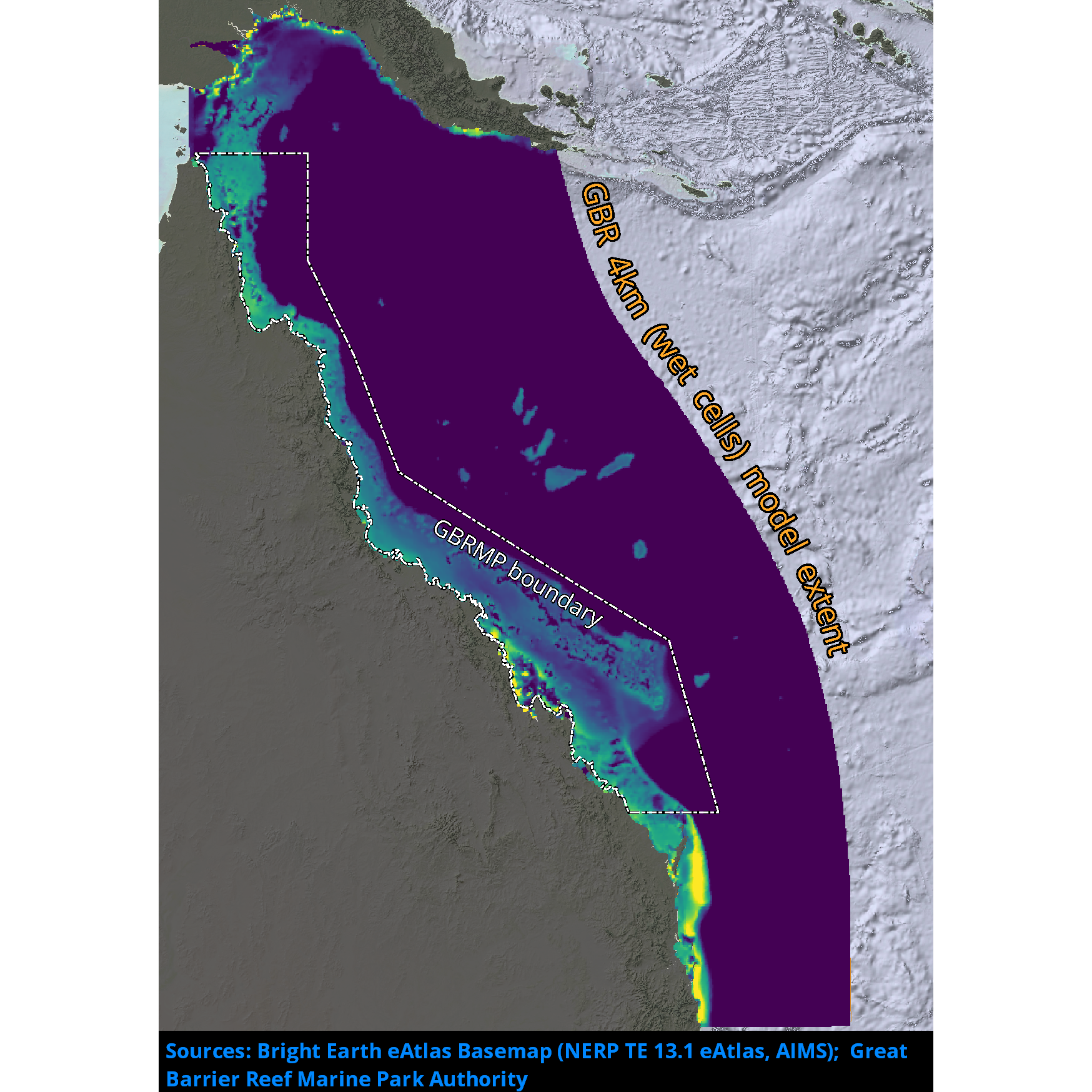
Results from version 3.1 of the 4km-resolution biogeochemistry and sediments model of the Great Barrier Reef (GBR4), forced by version 2.0 of the 4km-resolution hydrodynamic model and by a baseline catchment scenario which is derived from P2R SOURCE Catchments with 2019 catchment condition from December 1, 2010 to June 30, 2018 and from empirical SOURCE Catchments with 2019 catchment condition from July 1, 2018 to April 30, 2019. This model configuration and associated results dataset may be referred to as "GBR4_H2p0_B3p1_Cq3b_Dhnd" according to the eReefs biogeochemical simulation naming protocol. The model ran in hindcast-mode as one of a suite of simulations which included pre-industrial (GBR4_H2p0_B3p1_Cq3p_Dhnd) and reduced-load (GBR4_H2p0_B3p1_Cq3R_Dhnd) catchment scenarios.
-
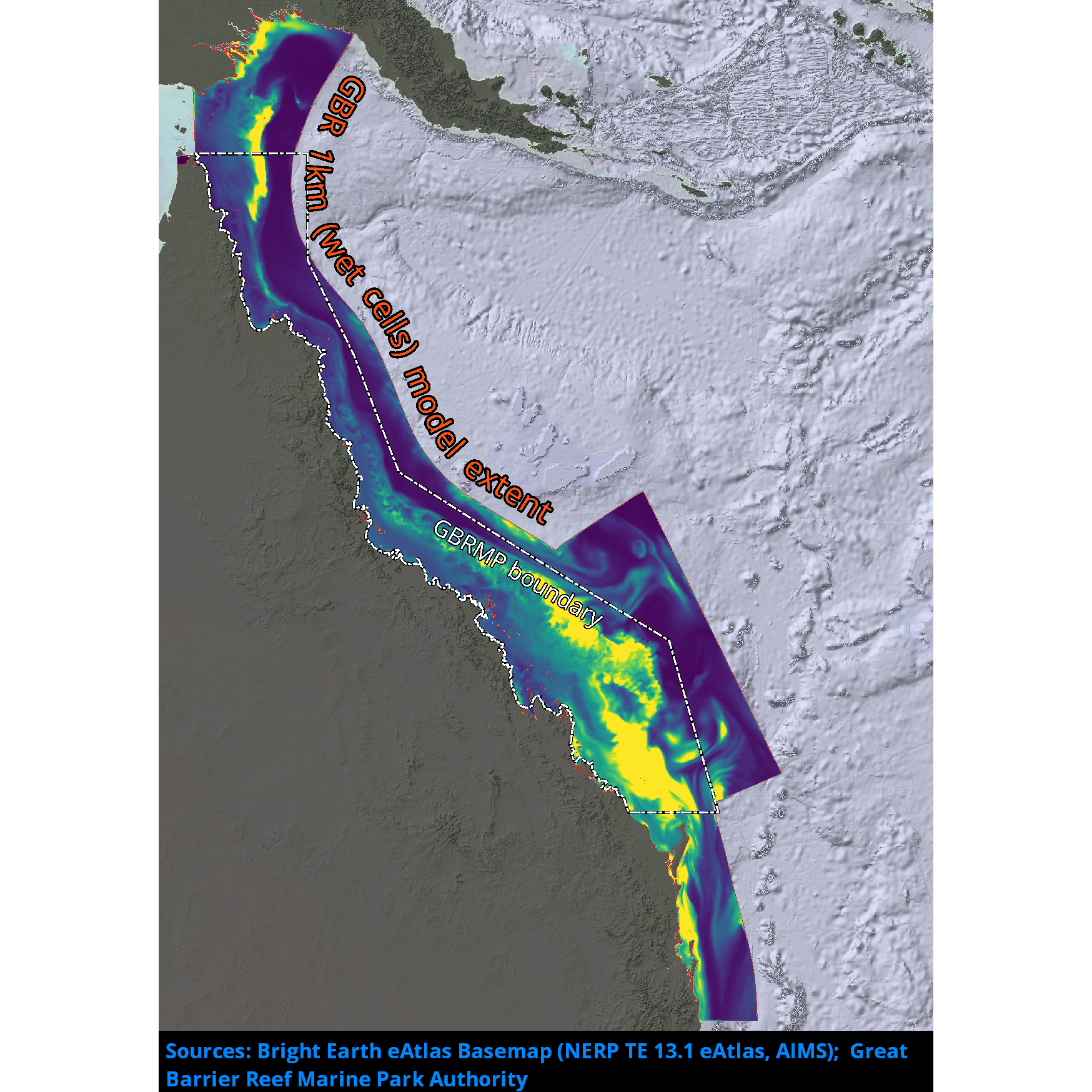
Results from version 3.2 of the 1km-resolution regional-scale biogeochemistry and sediments model of the Great Barrier Reef (GBR1), forced by version 2.0 of the 1km-resolution hydrodynamic model and with Furnas relationships for wet and dry tropics rivers as catchment inputs. This model configuration and associated results dataset may be referred to as "GBR1_H2p0_B3p2_Cfur_Dnrt" according to the eReefs biogeochemical simulation naming protocol. The model runs in near-real-time mode, updating daily.
-
This record describes the End of Voyage (EOV) archive from the Marine National Facility (MNF) RV Investigator research voyage in2016_v04, titled "Influence of temperature and nutrient supply on the biogeochemical function and diversity of ocean microbes." The voyage took place from Sydney (NSW) to Brisbane (QLD) between August 31 and September 22, 2016. Main project: Influence of temperature and nutrient supply on the biogeochemical function and diversity of ocean microbes. Supplementary project: Natural iron fertilisation of oceans around Australia: Linking terrestrial dust and bushfires to marine biogeochemistry. For further information about these projects please refer to the Voyage Plan and Voyage Summary. Data collected include: Regular measurements: Acoustic Doppler Current Profiler (ADCP; 75, 150 KHz ), Fisheries Echosounder (EK60), Multibeam Echosounder (EM710, EM122), Sub-bottom Profiler (SBP120), GPS Positioning System, Doppler Velocity Log, Radiometers, Pyranometers, Radon, Weather Radar, Greenhouse gas analysers (Aerodyne, Picarro), Air Pressure, Wind Speed and Direction, Photosynthetically Active Radiation (PAR), Ozone, Thermosalinographs, CTD, Expendable Bathythermographs (XBTs). Voyage Specific measurements: Condensation Particle Counters (CPC), Cloud Condensation Nuclei Counter (CCN, ccnc), Gravity Meter, pCO2, Hydrochemistry, Scanning Mobility Particle Sizers (SMPS), PAM fluorometer, Dissolved Inorganic Carbon (DIC), EZnet, Triaxus. The archive for the IN2016_V04 EOV raw data is curated by the CSIRO Oceans and Atmosphere (O&A) Information and Data Centre (IDC) in Hobart, with a permanent archive at the CSIRO Data Access Portal (DAP, https://data.csiro.au/dap/), providing access to participants and processors of the data collected in the MNF RV Investigator IN2016_V04 voyage.
-
This record describes the End of Voyage (EOV) data archive from the Marine National Facility (MNF) RV Investigator voyage IN2023_E03, titled "Trials and Calibrations." The voyage consisted of three legs and took place between September 13, 2023 and September 30, 2023 (AEST), departing from Hobart and returning to Sydney. For further information please refer to the voyage documentation links. Instruments used and data collected include: Regular measurements: Lowered ADCP (LADCP), Acoustic Doppler Current Profiler (ADCP; 75, 150 KHz ), Greenhouse Gas Analysers (Picarro), Cloud Condensation Nuclei counter (CCN), Condensation Particle Counters (CPC), Disdrometer, Radon sensor, Scanning Mobility Particle Sizers (SMPS), CTD, Fisheries Echosounder (EK80), Multibeam Echosounder (EM710, EM122), Sub-bottom Profiler (SBP120), GPS Positioning System, Doppler Velocity Log, Thermosalinographs (TSG), Fluorometer, Oxygen Optode, pCO2, Multiangle Absorption Photometer (MAAP), Ozone Sensor, Nephelometer, Atmospheric Temperature, Humidity, Pressure, Wind and Rain sensors, Photosynthetically Active Radiation (PAR) sensor, Precision Infrared Radiometer (PIR), Precision Spectral Pyranometer (PSP), ITI Trawl Net, Starboard and Portside Radiometers, Air Sampler, Ultra Short BaseLine Underwater Positioning System (USBL), Weather Radar, Expendable Bathythermographs (XBTs). Voyage-specific measurements: Triaxus, Deep Towed Camera (DTC), Multiple Plankton Sampler (HydroBIOS Multinet; Mammoth), Rectangular Midwater Trawl (RMT), Bioluminescence sensor (Glowtracka). The archive for the IN2023_E03 EOV raw data is curated by the CSIRO National Collections and Marine Infrastructure (NCMI) Information and Data Centre (IDC) in Hobart, with a permanent archive at the CSIRO Data Access Portal (https://data.csiro.au/), providing access to voyage participants and processors of the data collected on the voyage. All voyage documentation is available electronically to MNF support via the local network. Applications to access voyage documentation by non-CSIRO participants can be made via data-requests-hf@csiro.au. All processed data from this voyage are made publicly available through the MNF Data Trawler (in the related links).